WANDER
IN
WORDS
BANDELIER NATIONAL MONUMENT, 1991 / MARSHA DAHLSEID
Faded memories come into focus while visiting a stunning New Mexico monument

The few mental snapshots of northern New Mexico I'd managed to hold onto were grainy and blurred, diminished in quality by a prolonged absence but still retained in my mind to provide a touchstone to a time and a place steeped in pure wonder. Some of my earliest memories were formed here as a 5-year-old with my nose pressed up against the backseat window of my family's minivan, transfixed by the magical landscapes that affect anyone who spends any amount of time here. The canyons, mountains, mesas, yuccas, junipers, piñons, ponderosa pines, prickly pears and purple-orange sunsets combine to create a place that isn't just seen, but felt. The land beckons your eye, stops you in your tracks and persuades you to take time to admire its splendor.

When you enter New Mexico, it also enters you. When you leave, that piece inside you stays. It acts like a magnet, pulling you back to the source. After a quarter century away, I couldn't deny the pull any longer.

In early May, as part of a two-month camping odyssey across the American West, I dipped down from Colorado into New Mexico to check out a few new places and revisit some old ones. After a morning hiking at Kasha-Katuwe Tent Rocks National Monument and a late afternoon passing in and out of the endless art galleries around the Santa Fe Plaza, I took off to find a campsite at Bandelier National Monument — the first public land I ever hiked. Heading north up U.S. Route 84 past Camel Rock, I took the exit at Pojoaque as the sun set and traveled west on scenic New Mexico State Road 502 toward Los Alamos, where my family lived for less than two years in the early '90s. The road winds along the edge of a mesa that overlooks a canyon before taking you 7,320 feet above sea level to the town atop the Pajarito Plateau. I remember this drive better than anything else about Los Alamos, and as night fell my eyes strained to try to recognize distant rock formations that rise out of the canyon.

When you enter New Mexico, it also enters you. When you leave, that piece inside you stays. It acts like a magnet, pulling you back to the source.

This town is a town because of its location. Remote and secluded, the U.S. Department of War selected this area in 1942 as a secret site for the Manhattan Project. Scientists and support personnel, approximately 6,000 of them, were gathered at the Los Alamos National Laboratory to develop the first nuclear weapon during World War II. Within three years, Little Boy and Fat Man were created and dropped on Hiroshima and Nagasaki, resulting in more than 200,000 deaths and the end of the war.

You can learn about the history of “Atomic City” at various locations in Los Alamos, including the Bradbury Science Museum and one of three units of the newly established Manhattan Project National Historical Park. The lab itself is still in operation today and among the largest science and tech institutions in the world, conducting research in national security, supercomputing, renewable energy, nuclear fusion, medicine and more. Los Alamos and nearby White Rock have some of the highest concentrations of PhD holders and millionaires in America despite New Mexico being one of the country's poorest states. It's estimated that around 12 percent of Los Alamos' 12,019 residents are millionaires.

Hikers at Bandelier National Monument explore the cavates that were dug into the tuff walls of Frijoles Canyon by Ancient Puebloans.

About a dozen miles from where scientists and researches are developing the technology of tomorrow lies a place that offers a peek into the distant past. Paleoindians occupied the area now known as Bandelier 11,000 years ago, but the national monument's main draw is the result of habitation by Ancestral Puebloans during a period spanning from 1150 to 1550 A.D. Remnants of an array of ancient dwellings are scattered within just a couple miles of the visitor center. Many are accessible, with ladders leading into cavates (small man-made caves) carved out of soft volcanic tuff along the canyon walls. A highlight of a visit to Bandelier is a climb to Alcove House that takes hikers up four wooden ladders and stone stairways to an alcove 140 feet above the canyon floor.

Frijoles Canyon itself is a beautiful setting, with odd rock formations rising near the canyon walls and vegetation and wildlife teeming along El Rito de los Frijoles, or “The Little River of Beans.” It's no wonder the Ancient Puebloans settled in this little piece of paradise.

BANDELIER'S MAIN LOOP TRAIL WINDS THROUGH THE CANYON PAST ARCHAEOLOGICAL SITES
BANDELIER
FACTS & FIGURES
ESTABLISHED
FEBRUARY 11, 1916
NEAREST TOWN
LOS ALAMOS, NEW MEXICO
LAND AREA
33,677 ACRES
HIGHEST ELEVATION
10,199 FEET
(CERRO GRANDE)
LOWEST ELEVATION
5,000 FEET
2016 ATTENDANCE
198,478

A glimpse of the past

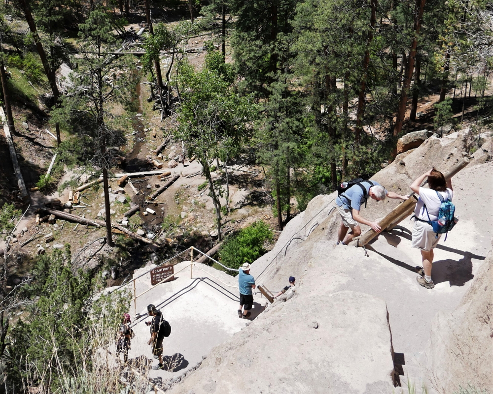
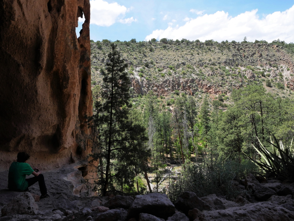
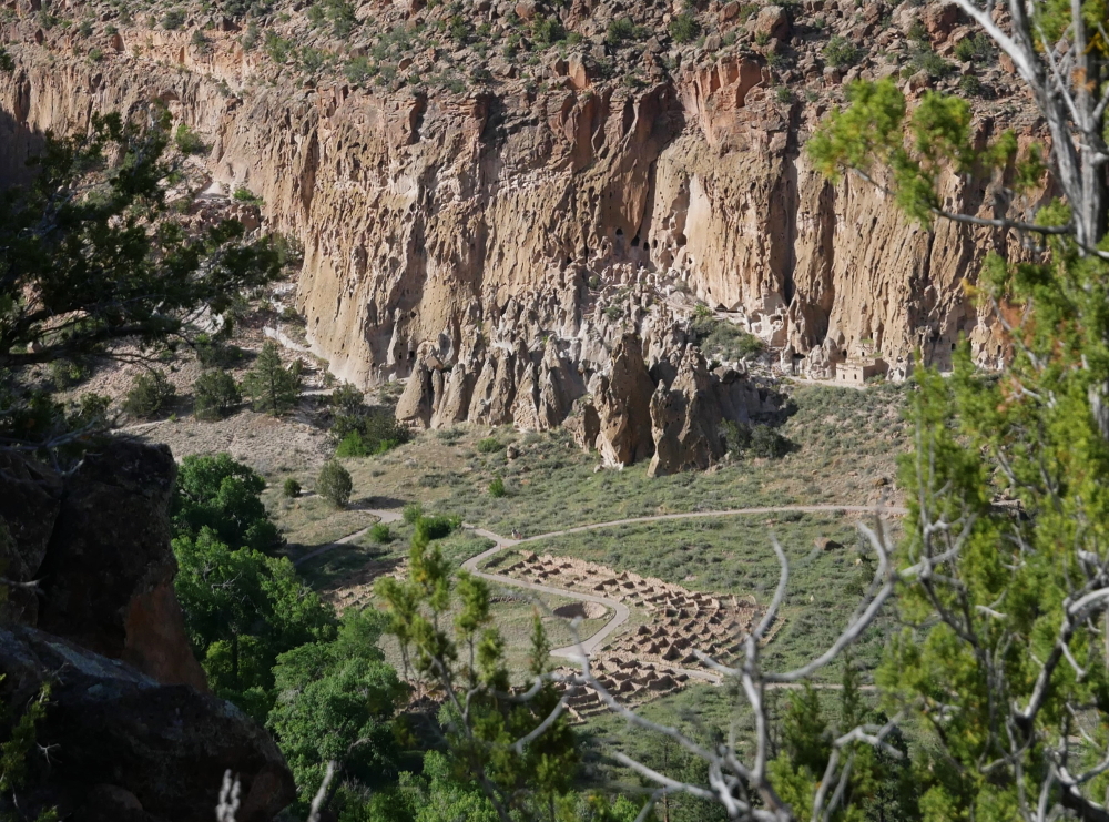
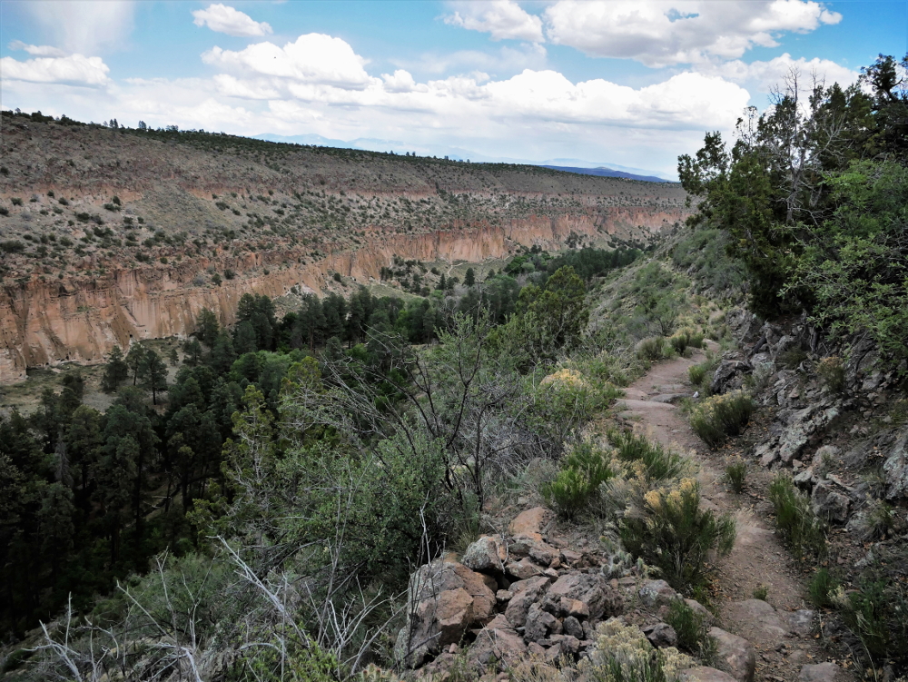
From the dry and brown mesa top, park visitors descend down a road along a canyon wall to what seems like a green oasis in comparison. The visitor center is surrounded by both deciduous and pine trees that run along El Rito de los Frijoles. Trails that lead up both sides of the canyon wall begin near here but the most popular path loops through the center.

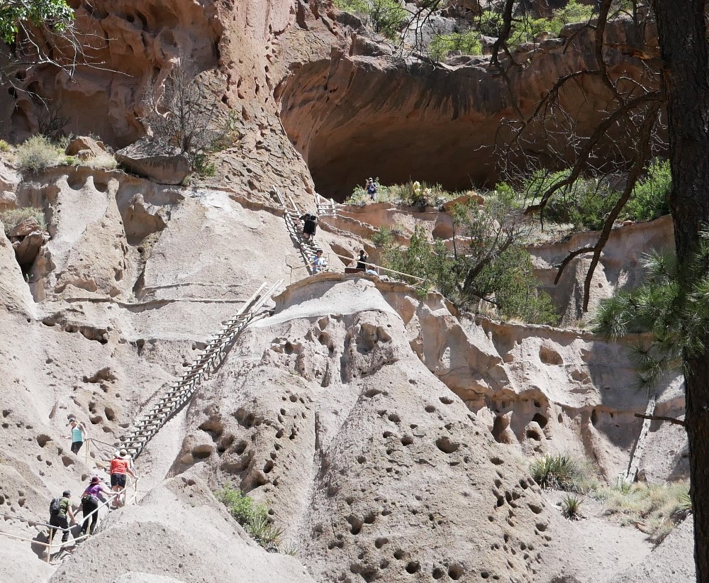
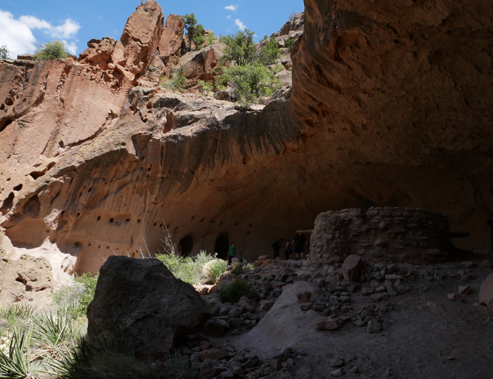
Within a short stretch of the 1.2-mile Main Loop trail, the evidence of a once-thriving community is unmistakable, yet the many dwellings and ruins blend in with the land without detracting from the natural beauty of this serene setting. A rugged coating of tan and white tuff (compressed volcanic ash) covers the canyon walls and is perforated with holes ranging from a few inches to a few feet in diameter. The largest holes are man made, carved out of the tuff that is the result of an eruption of the nearby Valles Caldera volcano more than 1 million years ago. Wooden ladders leading into these small dwellings allow visitors to climb inside to take in the view the Ancient Puebloans had hundreds of years ago.

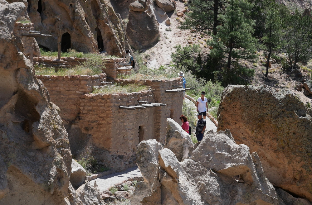
At the base of the canyon are the foundations of Big Kiva and the impressive Tyuonyi, a large circular pueblo built of stone blocks that once stood two to three stories tall and consisted of more than 400 compact rooms. The trail takes hikers through the ruins, the walls of which are only about six or seven stones high, and then up to a higher vantage point to allow for a better appreciation for Tyuonyi's size and shape. Nearby Talus House, fully reconstructed in the 1920s along the wall of the canyon, helps visitors envision how these structures appeared before they deteriorated.

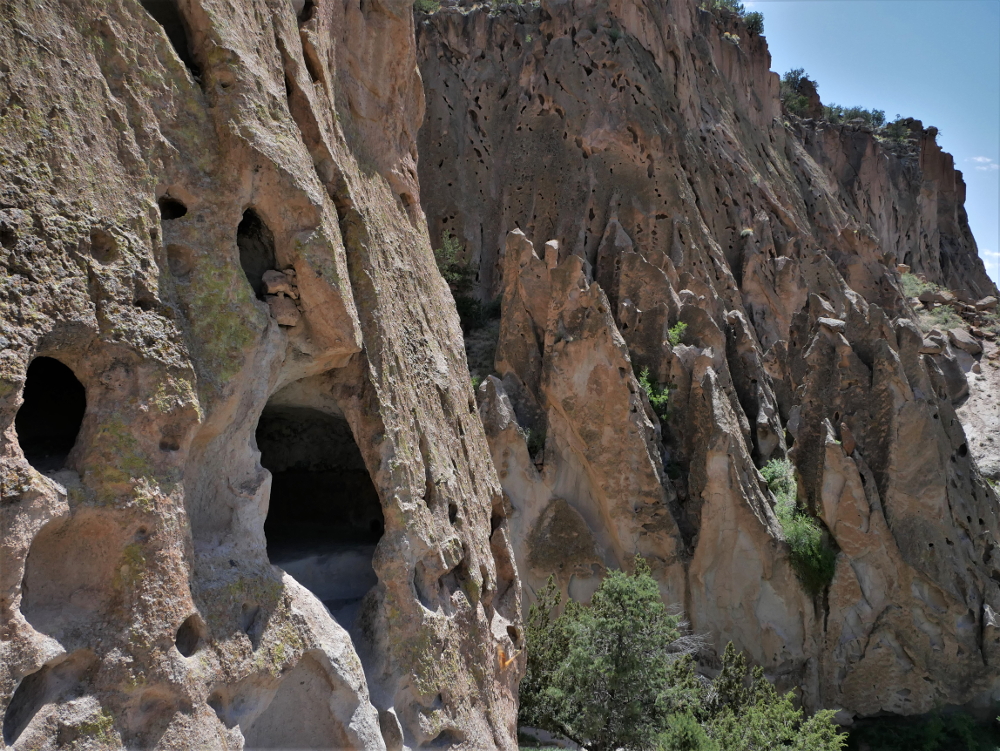
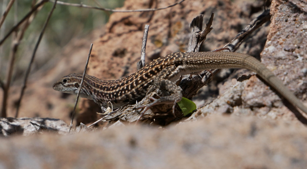
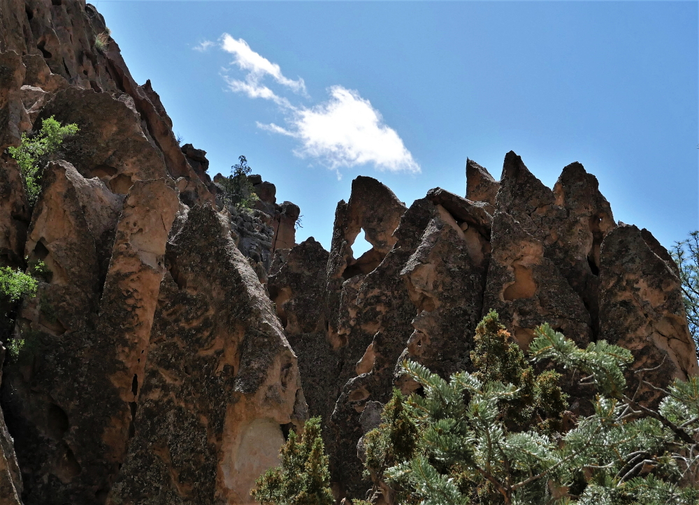
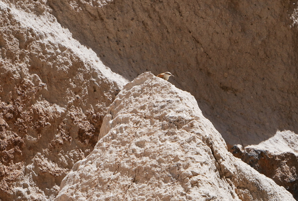
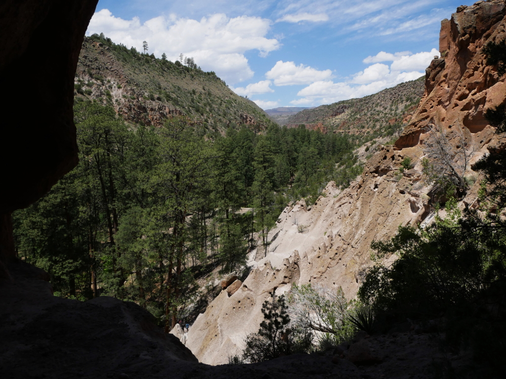
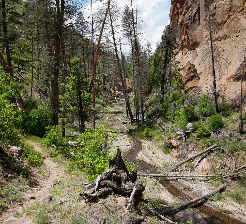
Jagged spires extend from the canyon wall like splayed feathers of a stone eagle. In tall vertical fissures, rock wrens perch and scan the land. Small lizards scurry about on and around gnarled rock formations while snakes slither in the grass below. This area's human inhabitants left long ago, but there's still plenty of life to be found here.

Depictions of life can be seen carved into the walls of the canyon in the form of petroglyphs dating back 500-plus years. Hundreds are along what used to be the back wall of Long House, a pueblo site that was once three to four stories high and built in front of several cavates. Turkeys, dogs, human-like faces, spirals and other designs can be seen upon a closer inspection.

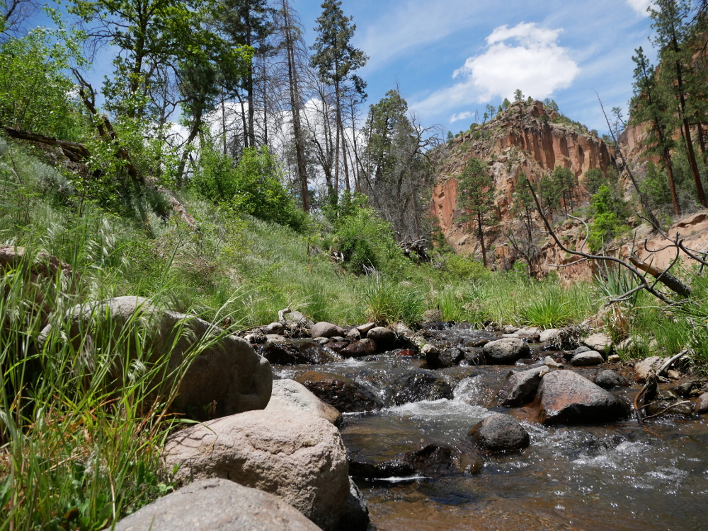
Up until this point, nothing I'd seen on the trail had jogged my faint 25-year-old memory of Bandelier. Then the path cut left toward the opposite wall, connected with a trail that followed the creek through the center of the canyon, I looked up, and there it was.

THE FIRST OF FOUR WOODEN LADDERS THAT LEAD UP TO ALCOVE HOUSE

To the top this time

My dad is climbing back down a tall wooden ladder offering words of encouragement and hands of support to my younger brother, who's just above him. We made it to the landing above the first of four ladders but Tom, just 4 years old, was too afraid to climb any higher.

He's frozen, unable to go down backwards after making it up. This isn't a McDonald's PlayPlace. There's no slide to deposit him safely into a pit of colorful plastic balls. Just a long, rocky drop.

My dad and brother pose at the top of the first ladder up to Alcove House in 1991. MARSHA DAHLSEID

With people above and below waiting to use the ladder, Tom starts to inch his way down while fighting back tears. Once he makes it to the ground, other hikers clap and cheer. Congratulations, Tom! You have a newfound fear of heights.

My memories came back with each smooth rung I grasped while making my ascent. The first ledge seemed familiar. I think it's where I stood and waited for Tom to get up the courage to climb back down. This time I was waiting for other families to make their way up or come down so I could continue to the alcove. No rush. Each break provides an opportunity to soak in the setting.

At the top of the fourth ladder and under the overhang is a large empty cavity that used to shelter approximately 25 Ancient Puebloans. The only structure visible today is a reconstructed kiva, but circular notches carved into the tuff walls where wooden beams were once inserted provide evidence that structures similar to Talus House and Long House once stood here.

The view is the best feature of Alcove House. I looked at the trees and the stream below with hikers walking along the trail, at the climbers on the ladders heading up to join me, and at the sprawling view farther up the canyon with fluffy white clouds grazing overhead. After I'd had my fill, I worked my way back down to decide where to go next.

Tom's only memories of Bandelier are the ladders and the applause he got when he made it back down. He's mostly overcome his fear of heights, but I'd like to get him back to Bandelier so he can conquer his old nemesis .

Hikers climb up four wooden ladders and stone stairs to reach Alcove House.
The view from a landing on the way up to Alcove House.
The silhouette of a man walking in Alcove House stands out against the opposite canyon wall.
An expansive view of Frijoles Canyon can be seen from inside Alcove House.
A reconstructed kiva sits below the overhanging cliff of Alcove House.
A boy looks out of Alcove House at the view from 140 feet above the floor of Frijoles Canyon.

THE VIEW FROM FRIJOLES RIM TRAIL

Away from the crowd

Bandelier covers more than 30,000 acres of land, but the vast majority of visitors stick to the Main Loop and Alcove House trails. Veer off on another path and there's a chance you'll have it all to yourself.

After climbing down from Alcove House, I continued up Frijoles Canyon Trail instead of turning back to the visitor center. The hike takes you off the paved and graveled paths you'll find on the Main Loop and onto that sweet, sweet dirt.

No two sections of the canyon appear the same. There's always some sort of crazy rock formation popping out of a cliff face or a cave or tent rock to compete for your attention. You'll also see dramatic evidence of the Las Conchas Fire, with charred trees and fallen, burnt logs scattered all about. Seventy-five percent of Frijoles Canyon was within the fire's footprint as the 2011 blaze burned an area of more than 150,000 acres. The area has been more prone to flooding due to the drastic reduction of plant life, but small shrubs and trees are popping up to provide splashes of green around the scorched remains.

A creek flows through Frijoles Canyon Trail surrounded by green vegetation and overlooked by a rise in the canyon wall.
An elevated trail overlooks El Rito de los Frijoles.
A small snake slithers along Frijoles Canyon Trail.
The ruins of Tyuonyi and tent rocks along the canyon wall are visible from Frijoles Rim Trail.
A path skirts the edge of the canyon cliff along Frijoles Rim Trail under partly cloudy skies.

I saw one other person while hiking about two miles up the trail and no one when I headed back as clouds gathered and the wind picked up strength. Nothing but a few sprinkles fell from the sky, and after reaching the visitor center I decided to take one more hike before returning to my campsite.

After being in the canyon all day, I wanted to get a different perspective and decided to climb up Frijoles Rim Trail. I hiked about an hour on the path and saw one couple. This trail provides tremendous views of the circular ruins of Tyuonyi and all the other archaeological sites along the Main Loop. The cavates among the tent rocks and rising pinnacles form a palatial scene. The clouds briefly parted and the sun lit up the canyon for about 10 minutes before its gray shroud returned.

I've only scratched the surface of exploring this gorgeous national monument. If you visit, look into checking out the Tsankawi section of the park. It's disconnected from the rest of Bandelier, about 12 miles to the northwest on New Mexico State Road 4, and contains a 1.5-mile loop trail along a mesa that includes ladders, cavates, petrogrlyphs and a unique narrow pathways carved several inches deep into the tuff by Ancestral Puebloans who lived in the village of Tsankawi. I wasn't aware of this portion of the park until after my visit but will definitely check it out in the future.

I drove out of Juniper Campground the next morning with new memories of Bandelier that won't soon fade. As I left New Mexico on my way to new adventures, I already felt a tug pulling me back. I don't have the strength to resist its draw for long.